
A First-Timer’s Guide to Visiting the Peak District
Planning your first Peak District visit? Learn how to choose the right base, build a realistic itinerary, prepare for changing weather and organise transport or parking backups—so you can enjoy the landscape without trying to cram too much into one trip.
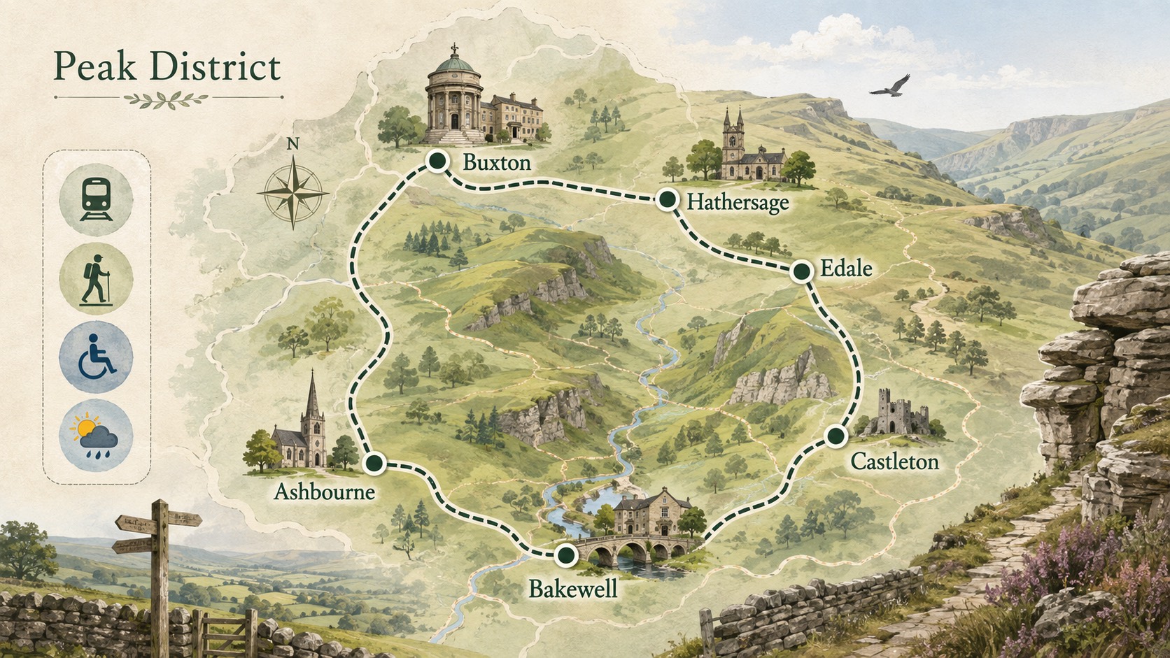
For a good first visit to the Peak District, plan less. Choose one base, one main landscape and one activity that fits the least experienced person in the group. Add a weather alternative and a transport backup. Trying to combine a long moorland walk, several villages and a major attraction in one day usually creates more driving than enjoyment.
The National Park is a lived-in working landscape spread across several counties, with narrow roads, active farms and popular beauty spots. Conditions can change quickly between a sheltered limestone dale and an exposed ridge, so time on a map is not the same as easy travel time.
Please note: The content below may contain affiliate links. If you make a purchase through these links, we could earn a commission, at no additional cost to you.
Choose the feel of the trip first
| Base or area | Works well for | Transport and planning note |
| Bakewell and the central dales | A town base, riverside time, limestone scenery and nearby traffic-free trails | Useful facilities; market and event days can affect parking |
| Castleton, Hope or Edale | Hope Valley rail access, caverns, hill walks and dramatic northern scenery | Direct trains serve several Hope Valley villages; popular starts fill early |
| Hathersage and the eastern edges | Rail access, village facilities and gritstone-edge walks | Match any edge route to wind, visibility and navigation ability |
| Buxton and the western side | A larger town base, architecture, dales and western routes | Useful for a mixed town-and-outdoors break; onward buses vary |
| Ashbourne and the southern trails | Cycling, gentler traffic-free routes and the southern dales | Good for a trail-centred visit; check cycle-hire and bus times |
These are planning starting points, not rankings. Pick the base that reduces travel to your main activity. If the first priority is walking from a railway station, the Hope Valley is a stronger fit than a remote car park. If the group wants cafés, shops and a short scenic outing, a town base may be easier.
Use a one-day or weekend template
A simple day trip
- Arrive at one base by mid-morning, with the return train, bus or backup car park already noted.
- Complete one route or activity that leaves a margin for stops and slower terrain.
- Have lunch in the same area rather than driving across the National Park.
- Use the afternoon for a village, visitor centre or short accessible trail, then leave before fatigue turns the final journey into a rush.
A balanced two-night break
Use the arrival day for the base itself, the middle day for the main outdoor activity and the final morning for a weather-flexible choice. This keeps the longest route away from check-in and check-out deadlines. Book only the activities that genuinely require it, but verify opening days, parking and last entry directly.
Consider rail and bus before defaulting to the car
The Hope Valley railway line between Manchester and Sheffield serves Grindleford, Hathersage, Bamford, Hope and Edale, giving direct access to several walking bases. Other towns around the park connect by bus, but rural services can be infrequent or seasonal. Use the operator or Traveline for the actual date and keep a screenshot or written note where mobile signal may be weak.
If driving, choose an official car park and record at least one alternative. The National Park Authority warns that some small car parks fill early and that even a parking permit does not guarantee a space. Do not park on grass verges, by farm gates, on restricted roads or where emergency and agricultural vehicles cannot pass.
Useful habit: Download the route, parking location and return transport before leaving accommodation. A postcode can cover a broad rural area, and the National Park warns that general map locations are not always suitable for sat-nav arrival.
Match the route to the whole group
Distance alone is a poor measure. Check ascent, surface, exposure, navigation, stream crossings, daylight and escape points. A short steep ridge in wind can be more demanding than a longer level trail. Use a current Ordnance Survey map or a reliable route guide and know whether you are following a public right of way, an all-user trail or open access land.
For an easier first outing, the National Park’s traffic-free trails and Miles Without Stiles routes provide clearer information. Miles Without Stiles routes avoid stiles and are graded ‘for all’, ‘for many’ or ‘for some’ with maps, photographs and access details. Read the individual route, because the grades describe different surfaces and gradients rather than promising universal access.
Prepare for Peak District weather
Check a mountain or local forecast on the morning, not only a city forecast the night before. Carry a waterproof layer, a warm layer, water, food, charged phone and route information. Wear footwear suited to the surface. In hot, dry conditions, carry more water and follow fire-risk restrictions; never use a disposable barbecue or light a fire on access land.
Turn back when the group is cold, visibility is deteriorating or progress is much slower than planned. Reaching a summit is optional; returning safely is the trip. For exposed moorland, winter conditions or scrambling, use the skills and equipment appropriate to that terrain or choose a guided activity.
Understand access rather than assuming ‘right to roam’
Public footpaths are routes for travel on foot. Bridleways also allow horse riders and pedal cycles. Open access land normally allows recreation on foot over mapped areas, but it does not create a general right to cycle, ride, camp, swim, light fires or drive away from existing rights. Temporary closures and local restrictions can apply, so follow signs.
Leave gates and property as you find them, take litter home, keep to marked routes where wider access is not available and avoid disturbing livestock or wildlife. The Peak District is not an outdoor theme park; people live and work beside the places you are visiting.
Bring a dog only with a workable plan
The National Park advises keeping dogs on a short lead around livestock and where wildlife may be disturbed. On open access land, the law requires a fixed lead no longer than 2 m from 1 March to 31 July, and at all times near livestock. Additional exclusions can apply on some moors or during land management. Carry water and waste bags, and choose a route the dog can physically manage.
Avoid the four common first-trip mistakes
- Too many locations: use one base and explore its immediate landscape.
- No parking or transport backup: save alternatives before setting out.
- A route chosen by distance alone: check gradient, surface, exposure and daylight.
- No indoor or accessible alternative: keep a visitor centre, town walk, cavern or graded easy-access route in reserve and verify opening details.
Your final check the evening before
Confirm the forecast, route status, parking or timetable, daylight, clothing and the group’s limits. Share the plan with everyone and agree the turnaround point. A modest first visit that leaves you wanting to return is a better introduction than a packed itinerary completed under pressure.
Peak District Guide: Companion Downloads
Download and keep these handy, free checklist and planner files to get the most out of your trip to the Peak District:
External reference links
Subscribe for more
Get the latest posts delivered monthly so you never miss an article. Sign up below:
